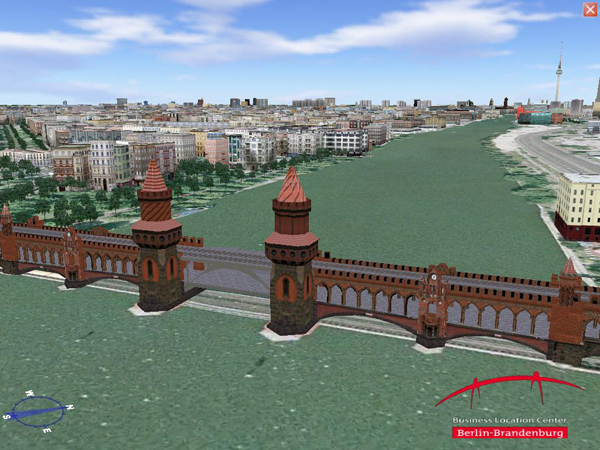
Berlin has been the first and is still the largest city that can be searched and explored on Google Earth in all of its aspects. It consists of approximately 500,000 buildings in CityGML Level of Detail (LoD)2, located on the 890 square kilometer of the city’s area. This model is neither a commercial model nor based on commercially available three-dimensional models. It was rather developed by the State of Berlin through the Senate Department of Urban Development, the Senate Department for Economics, Technology, and Women's Affairs, the Berlin Partner GmbH and the Berlin University of Technology. In order to explore this model you have to disable the original GoogleEarth layer "3DBuildings".
Right click on the kmz file below and choose "Save target as". Start kmz file with Google Earth.
Download: 3D_GeoInfo.kmz |
|