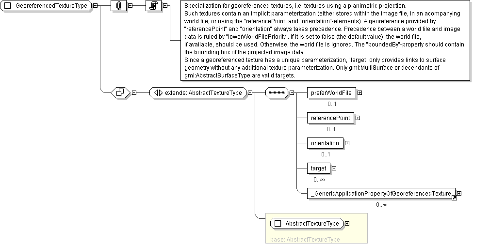
Diagram

| Super-types: | gml:AbstractFeatureType < AbstractSurfaceDataType (by extension) < AbstractTextureType (by extension) < GeoreferencedTextureType (by extension) |
|---|---|
| Sub-types: | None |
| Name | GeoreferencedTextureType |
|---|---|
| Used by (from the same schema document) | Element GeoreferencedTexture |
| Abstract | no |
| Documentation | Specialization for georeferenced textures, i.e. textures using a planimetric projection. Such textures contain an implicit parameterization (either stored within the image file, in an acompanying world file, or using the "referencePoint" and "orientation"-elements). A georeference provided by "referencePoint" and "orientation" always takes precedence. Precedence between a world file and image data is ruled by "lowerWorldFilePriority". If it is set to false (the default value), the world file, if available, should be used. Otherwise, the world file is ignored. The "boundedBy"-property should contain the bounding box of the projected image data. Since a georeferenced texture has a unique parameterization, "target" only provides links to surface geometry without any additional texture parameterization. Only gml:MultiSurface or decendants of gml:AbstractSurfaceType are valid targets. |
'Multiple names may be provided. These will often be distinguished by being assigned by different authorities, as indicated by the value of the codeSpace attribute. In an instance document there will usually only be one name per authority.'
